Cycling route planner
Plan the ride.Trust every number.
RidePlanner only shows what it has measured. One climbing figure on screen, on paper and in your FIT file. Detours routed on real roads. Col sides measured from elevation data, or plainly marked "not mapped yet".
No account needed to plan a route or find water. Log in to save and share.

- One D+ everywhere
- Detours routed, not estimated
- Steepest over 500 m
- 24-hour roadbook print
Numbers you can check
When we can’t measure something, we say so. We don’t guess.
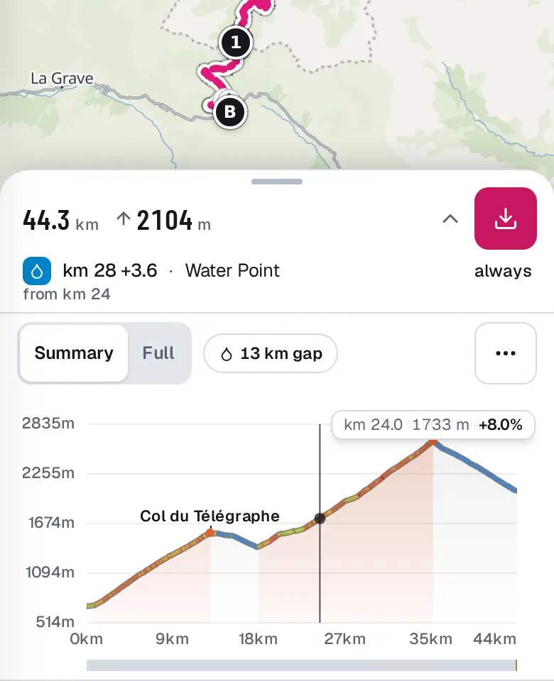
- D+ 2104 m
One climbing figure
The same D+ on the ride card, the roadbook and the total ascent in your FIT file, to the metre. Ups and downs under 5 m don’t count, so elevation noise doesn’t add metres.
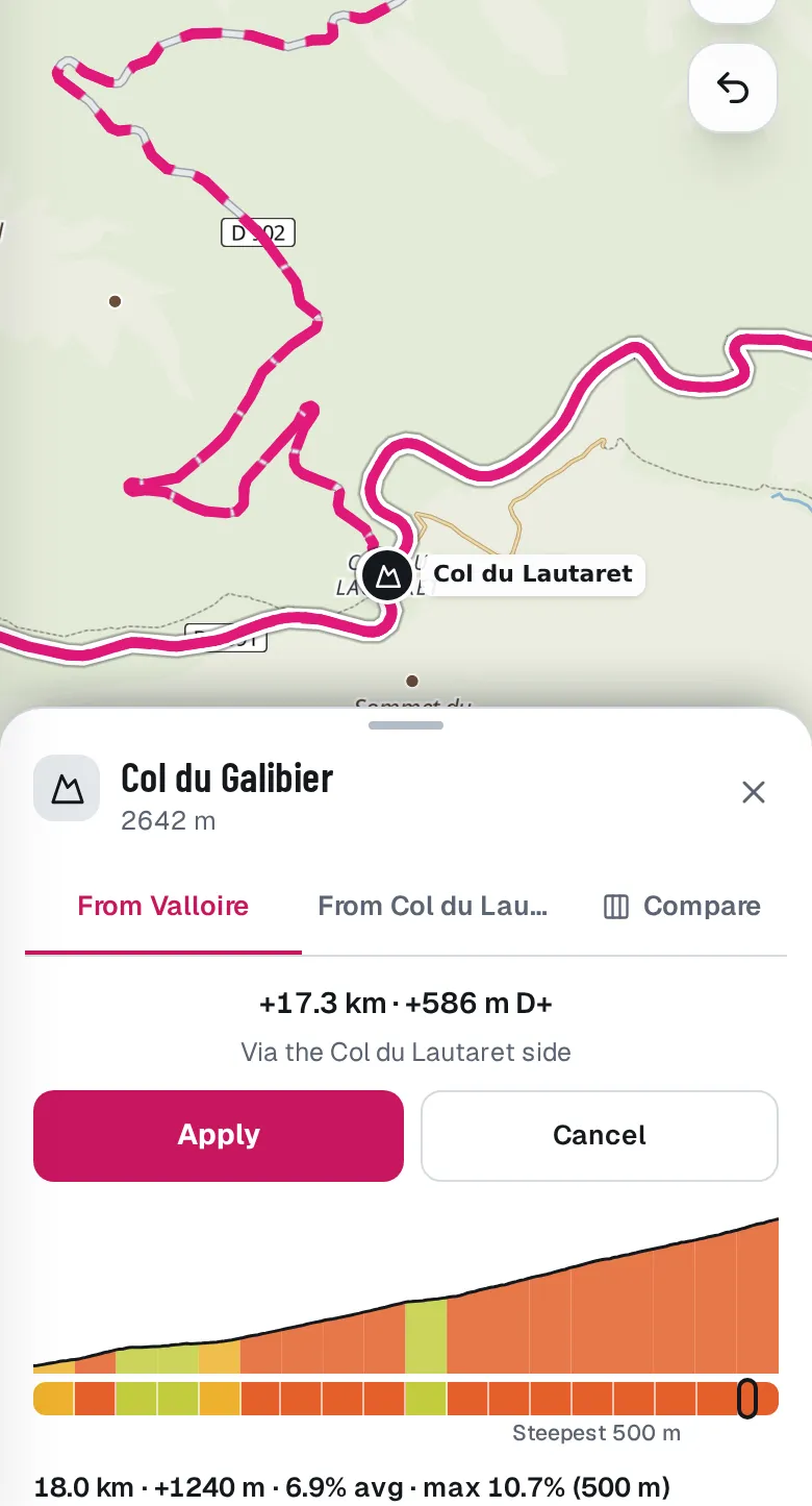
- +17.3 km · +586 m D+
Detours routed, never estimated
Open a col and tap Add as detour: we route the way over its summit on real roads and show exactly what it adds, new roads dashed on the map. Apply it or cancel.
- Sides not mapped yet.
Col sides measured, or not shown
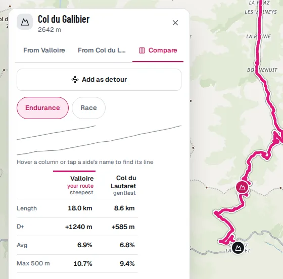
Each side is measured from our elevation data along the real road: length, climbing, average, steepest 500 m. A side only shows when its numbers are right.
- max 10.7% (500 m)
Steepest over 500 m
Elevation data is too rough to trust over 100 m, so the steepest figure is always over 500 m, with a note on how precise it is.
- Fetched more than 6 h ago
Forecasts with a source and a time
The roadbook shows the temperature and rain chance beside each time, says when the forecast was fetched, and turns amber after 6 hours.
- Checking…
Never an old figure
After you edit the route, figures say Checking… until the new ones are in. If an update fails you get Retry, not a stale number.
From the desk to the café stop
Plan in the evening on a big screen. Check it on your phone with one thumb.
Where is the next water?
"Next water km 28 (+3.6)", with the place’s name and whether it’s open when you get there. Fountains say "always"; places without hours say "hours ?", never "open".
The road surface, stretch by stretch
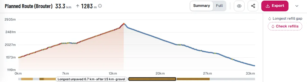
A band under the profile shows paved, gravel, dirt and cobbles, from OpenStreetMap tags. Untagged stretches are hatched grey, not guessed.
Split a long trip into days
Each day gets its km, climbing, arrival time, its own roadbook and its own FIT course starting at 0 km.
Your pace, your wind
Pick your effort and position, and see what time you pass each km with the wind you’ll face: head, tail or cross.
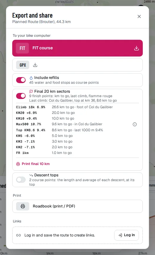
On paper and on your bike computer
One Export for the FIT course, the roadbook and your share links.
A FIT course with course points
Named cols, water and food stops, your notes, and finish markers at 20, 10, 5, 3 and 2 km to go, with the elevation. Toilets go as plain points, never as water.
A one-page roadbook
Map, profile, climbs, notes, water with opening hours and passing times on one A4 sheet. Printed times are always 24-hour.
A final-10 km card
The last climb, the last descent and the gradient of each km to go, printed big enough to tape to the stem.
Links that end after race day
Share a route by private link. Each link says when it expires and whether anyone opened it.
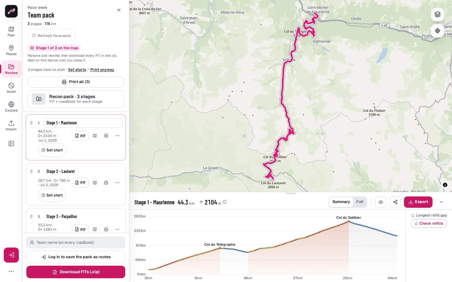
Race week, for directors
Team mode at /team puts every stage in one pack.
Every stage in one pack
Drop all your stage GPX or FIT files at once, rename and reorder them. The recon pack saves each stage’s FIT and prints its roadbook in one tap, named like Tour_D2_62km. A stage that fails retries on its own.
A link for each rider
Each rider gets a link named after them, valid until the end of race day. The pack shows how many have opened theirs.
Real start times, no guessed times
Set each stage’s real start: its finish time, forecast and roadbook follow. A stage without a start prints "NO START SET", not a made-up time.
Feed zones your soigneur can reach
Feed and meeting points carry coordinates, Open in Maps and a QR code on paper, and a window marked EST. that you can shift when the race runs late.